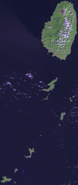
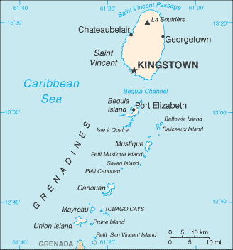
Comprised of one major island (Saint Vincent) and a chain of smaller islands extending to the south (the Grenadines), Saint Vincent itself is a perfect example of a volcanic island. It reaches a height of 1234 meters (4048 feet) at the peak of La Soufrière (“the Sulfurer”), an active volcano which last erupted in 1979. The rest of the island is rather mountainous with scant stretches of level ground. The western side of the island is especially rocky, while the eastern side is noted for descending to the water on a much smoother angle, as well as having the better beaches.
South of Saint Vincent itself is Bequia, the second largest of the Grenadines (and the largest island claimed by Saint Vincent). Of course, this is a relative term, as Bequia is still only 7 square miles in area, as compared to Saint Vincent’s 133. The rest of the Grenadines (there’re over 600) extend south for some 25-30 miles, eventually ending in the island of Grenada (which claims six of the Grenadines as part of its territory).